Horton Plains and World's End: Plan Your Hike
Contents
- 1. The main walking circuit
- 2. Early viewing, admission and changing weather
- 3. Budget for entry and the road transfer
- 4. Road approaches and Ohiya rail connections
- 5. Landscape, wildlife and World Heritage context
- 6. Clothing, supplies and the rest of your itinerary
- 7. Sources and background
- 8. Frequently Asked Questions
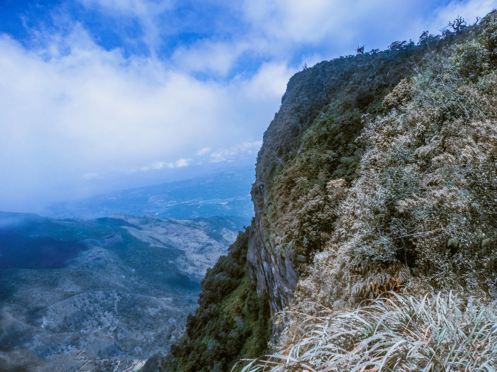
Horton Plains is a highland walk through grassland and cloud forest, and it ends at World's End, an escarpment with a drop of about 900 m.[1] The view is the prize, but mist often takes it, so keep the day flexible and start early.
| Base | Why it suits | Approach |
|---|---|---|
| Nuwara Eliya | Make the park part of a local overnight stay | Road via Ambewela and Pattipola, 32 km[2] |
| Ella or Haputale | Keep your hill-country base | Road via Haputale or Welimada, Boralanda and Ohiya, 38 km[2] |
| Ohiya station | Arrive by train on the Kandy-Badulla or Colombo-Badulla line | Get off at Ohiya, then the park entrance is about 10 km away by road[2] |
Ask your driver where the walk starts, where they will wait and what happens if you finish later than planned.
The main walking circuit
The visitor centre is the start of the main circular walk of 9 km.[2] Allow extra time for stops, photographs and your own pace.
World's End is the main escarpment viewpoint: the plateau ends suddenly in a sheer drop of about 880 to 900 m.[2][1] Stay well back from the edge, especially when mist hides the drop.
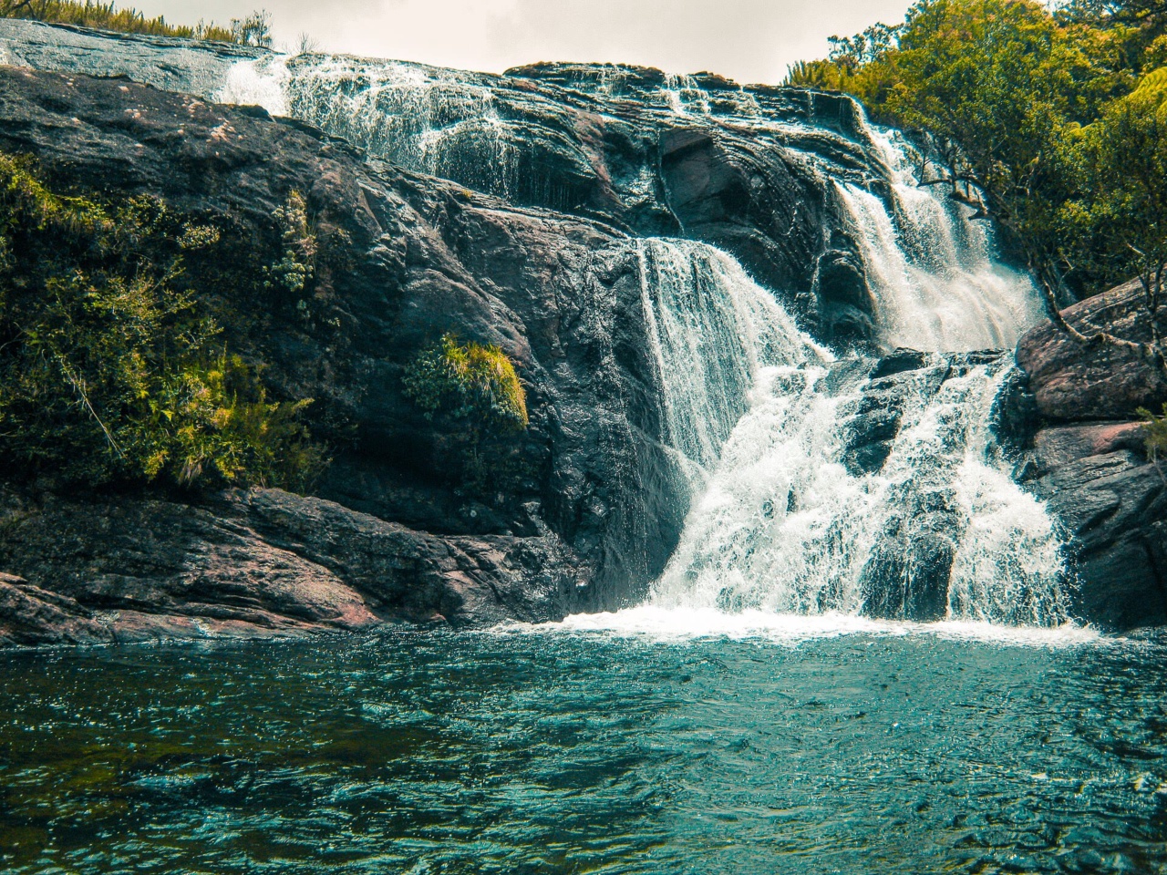
Ask at the visitor centre which paths and viewpoints are open, and walk the circuit in the order the staff recommend. Baker's Falls and the cloud forest along the way make the walk worthwhile even when World's End is wrapped in white.
Things to Do
Offers are only loaded from GetYourGuide after you click. GetYourGuide can then process your IP address and set cookies. Privacy Policy
GetYourGuide partner offers. GoAsia may earn a commission if you book through these offers. Check whether tickets or transfers are included, and follow the attraction's official booking and admission rules.
Early viewing, admission and changing weather
The best time to visit is early morning, between 06:00 and 10:00, before the clouds roll in.[2] The panoramic views get obscured by mist from around 10:00 onwards, and the mist is particularly thick in the rainy months of May to July.[1] The weather is clearer from January to March.[2] Even then, keep a postponement option for heavy rain or poor visibility.
Budget for entry and the road transfer
Visitors enter the national park with a permit issued by the Department of Wildlife Conservation, against the prescribed fee.[3] Ask for the current amount for your visitor category and for an itemised transfer quote, including waiting time and the return trip, before you book. If you share a vehicle, agree the number of paying passengers and the pickup time in advance.
Road approaches and Ohiya rail connections
Three road approaches lead to the plateau: via Nuwara Eliya, Ambewela and Pattipola (32 km); via Haputale or Welimada, Boralanda and Ohiya (38 km); and via Nuwara Eliya, Hakgala, Rendapola, Ambewela and Pattipola (38 km).[2] Arrange a pickup from your accommodation, and book the return at the same time.
Ohiya station is not the park entrance: you need a road transfer of about 10 km to reach it.[2] Arrange that leg and the return before you rely on a train arrival.
Train services from Badulla to Nanu Oya have resumed after the Ambewela-Nanu Oya section, damaged by Cyclone Ditwa, was restored.[4] Check the timetable with Sri Lanka Railways before you plan around a particular train.
Landscape, wildlife and World Heritage context
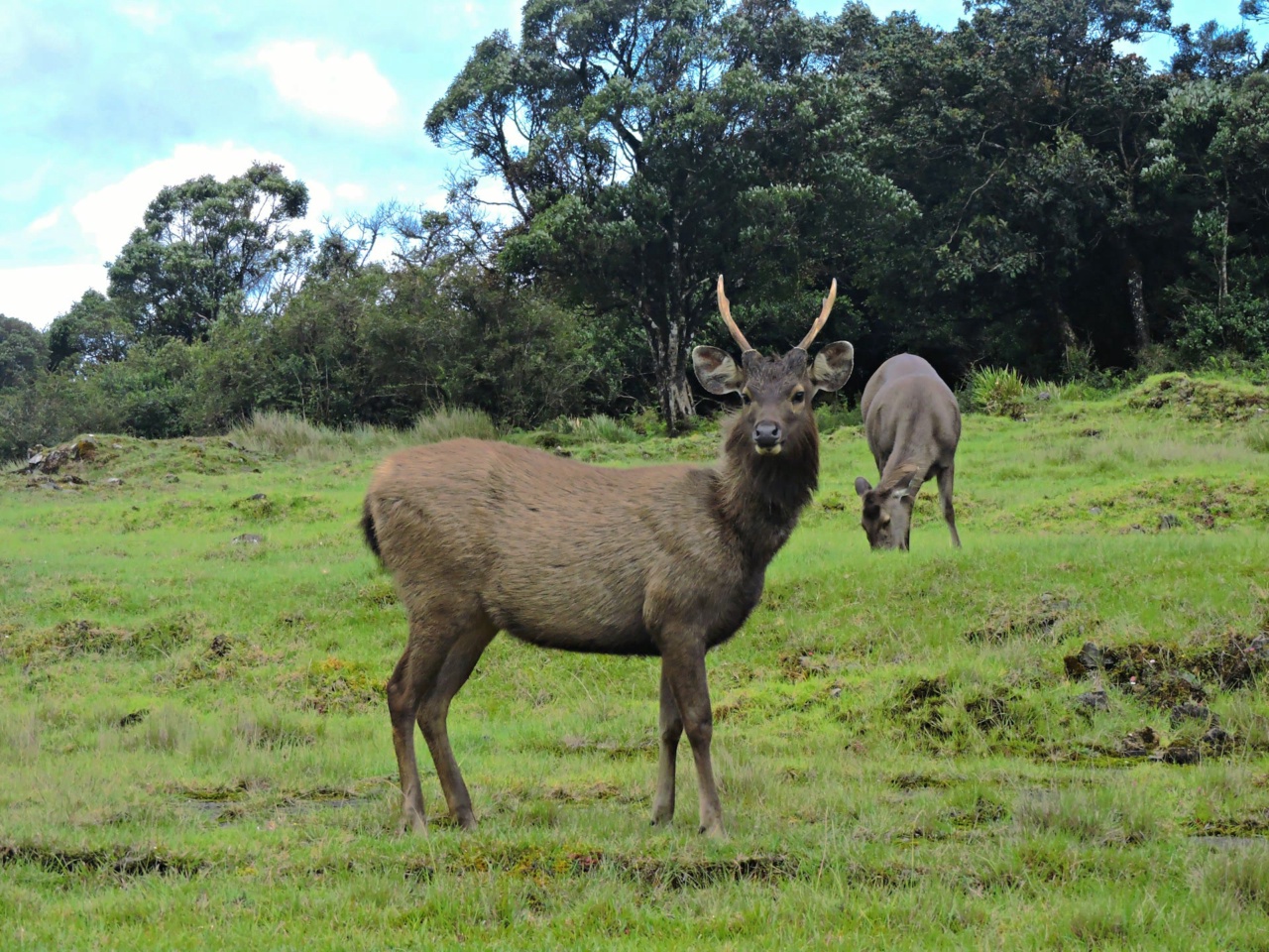
World's End sits on the southern edge of the plateau at an altitude of 2,140 m.[1] Herds of sambar deer are the most frequent wildlife sight, and endemic highland birds such as the Sri Lanka whistling thrush, the Sri Lanka bush warbler and the yellow-eared bulbul live in the forest.[1]
Horton Plains is one of the three components of the Central Highlands of Sri Lanka World Heritage property, together with the Peak Wilderness Protected Area and the Knuckles Conservation Forest.[5] Stay on the permitted paths and leave wildlife undisturbed.
Clothing, supplies and the rest of your itinerary
Wear closed walking shoes and bring layers, rain protection, water and food for the outing. The plateau is cool and often wet, so a waterproof jacket earns its place in the bag. Keep away from exposed edges, follow staff instructions and turn back if conditions make continuing unsafe.
Leave a buffer if you link the walk with an onward connection: separate the approach, the circuit, a rest and the return when moving between Nuwara Eliya, Ella, Haputale or Kandy. Adam's Peak needs its own planning and is not a same-day extension. See Sri Lanka travel information for the wider itinerary.
Sources and background
Numbers in the text such as [1] refer to these sources.
- [1] Central Province Tourism Department: Horton Plains. Retrieved October 21, 2026.
- [2] Sri Lanka Tourism Development Authority: Horton Plains. Retrieved October 21, 2026.
- [3] Department of Wildlife Conservation, Sri Lanka: National Park. Retrieved October 21, 2026.
- [4] Sri Lanka Railways: Sri Lanka Railways home page: Badulla to Nanu Oya services resumed. Retrieved October 21, 2026.
- [5] UNESCO World Heritage Centre: Central Highlands of Sri Lanka. Retrieved October 21, 2026.
Frequently Asked Questions
Yes. The grassland, cloud forest and Baker's Falls can make the walk worthwhile even without a long panorama. Go early, check the forecast and keep the day flexible.
Entry is by permit issued by the Department of Wildlife Conservation, against the prescribed fee. Ask for the amount for your visitor category and for an itemised, dated return-transfer quote including waiting time.
You can take the Kandy-Badulla or Colombo-Badulla train to Ohiya, but Ohiya is not the park entrance: the entrance is about 10 km away by road, so arrange a transfer and the return in advance.
Early. The best viewing is between 06:00 and 10:00, before the clouds roll in, and the mist can obscure the views from around 10:00 onwards.
The main circuit is 9 km and starts at the visitor centre. Actual time depends on your pace, weather and stops, so allow extra time for photographs and rests.
Closed walking shoes, layers, rain protection, drinking water and food for the outing. Follow staff instructions, stay on permitted paths and keep away from exposed cliff edges.
Yes. The road approach from Haputale via Boralanda and Ohiya is 38 km. Plan the full road transfer, the walk and the return before booking, and leave a buffer before any onward train, bus or flight.