Mayon Volcano Albay: Viewpoints and Visit Planning
Contents
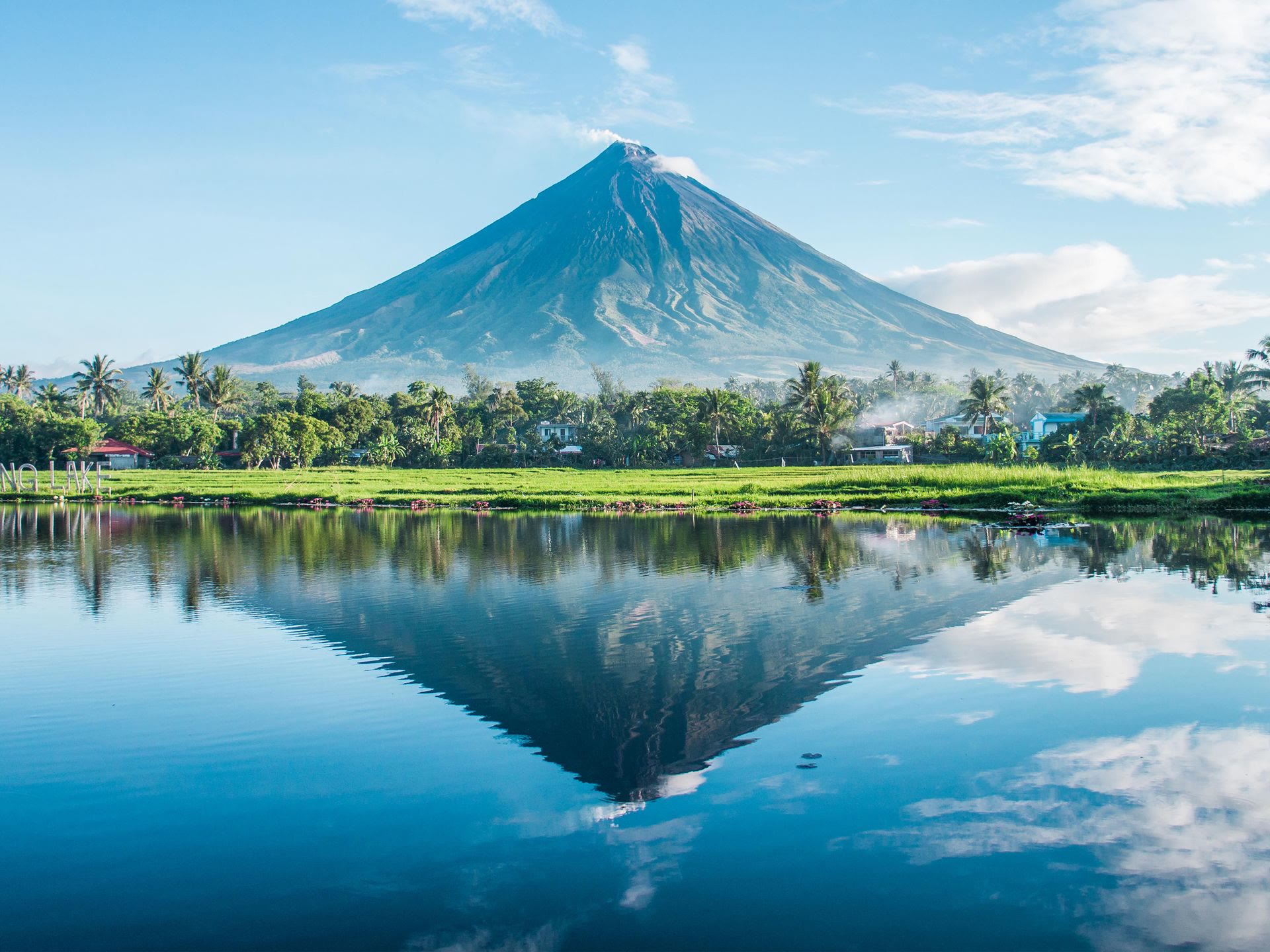
Mayon is an active volcano in Albay, Philippines, and one of the country's most photographed cones. Start with PHIVOLCS before you choose a route: its bulletin index listed Mayon at Alert Level 2 on 21 October 2026.[1] That is a snapshot, not a forecast, so check the newest bulletin before you go.
Check the current danger zone first
At Alert Level 2, PHIVOLCS describes unrest that is probably of magmatic origin and could eventually lead to an eruption. The 6-km radius danger zone may be extended to 7 km in the sector where the crater rim is low.[2] Read the latest bulletin and follow local instructions before you pick any stop or activity.
A summit climb is not an option. Do not enter the danger zone, and do not follow a guide or tour route into it. For any lower-slope walk or ATV offer, ask the operator for the exact route and endpoint, then confirm that it stays outside the current PHIVOLCS danger zone and any local closure before you pay.
Things to Do
Offers are only loaded from GetYourGuide after you click. GetYourGuide can then process your IP address and set cookies. Privacy Policy
GetYourGuide partner offers. GoAsia may earn a commission if you book through these offers. Check whether tickets or transfers are included, and follow the attraction's official booking and admission rules.
Choose a viewpoint as a separate stop
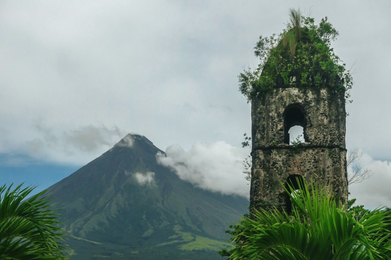
Mayon looks its best from a distance. The Cagsawa Ruins in Daraga are the remains of a 16th-century Franciscan church destroyed by the 1814 eruption, and the bell tower still stands against the cone.[3] In Legazpi City, Ligñon Hill has a view deck on the hilltop with a 360-degree view of the city.[4] Ask the municipality about current access and closures before you set out.
Plan transport to Albay by date
Daraga Bicol International Airport, which replaced Legazpi's old airport, uses the code DRP (LGP is no longer in use).[5] If you fly, check which airlines serve your dates and arrange the ground transfer locally.
By road, Bicol Isarog runs buses to Legazpi from EDSA Cubao (08:00), PITX (18:00 and 20:45, the later one a sleeper bus) and Arcovia Pasig (20:00).[6] Plan onward transport once you know which sights are open.
Make the activity decision last
Build the day around the latest official access notice, not around an old trail name or a vendor's general tour description. If the route or local status is unclear, leave the volcano activity out and spend the day at the viewpoints, which give you the cone without the risk.
For current safety information, use the PHIVOLCS bulletin list and its Mayon Alert Level guidance. For city viewpoints, see the Municipality of Daraga tourism page and Legazpi City attractions page. For transport, check the Bicol Isarog schedule and CAAP.
Sources and background
Numbers in the text such as [1] refer to these sources.
- [1] PHIVOLCS: Volcano bulletins: Mayon alert level, 21 October 2026. Retrieved October 21, 2026.
- [2] PHIVOLCS: Volcano Alert Levels (Mayon section revised 14 January 2018). Retrieved October 21, 2026.
- [3] Municipality of Daraga: Tourism Daraga: Cagsawa Ruins. Retrieved October 21, 2026.
- [4] Legazpi City government: Legazpi City Tourist Attractions: Ligñon Hill. Retrieved October 21, 2026.
- [5] Civil Aviation Authority of the Philippines: Advisory Circular No. 001-2022: Daraga Bicol International Airport IATA identifier. Retrieved October 21, 2026.
- [6] Bicol Isarog Transport System, Inc.: Trip Schedules: routes to Legazpi. Retrieved October 21, 2026.
Frequently Asked Questions
PHIVOLCS listed Mayon at Alert Level 2 on 21 October 2026. Alert levels change, so check the newest bulletin before you travel.
No. Do not enter the danger zone, and do not rely on a guide or tour offer to override the restrictions. Follow the newest bulletin and local instructions.
No. At Alert Level 2, PHIVOLCS says the 6-km radius danger zone may be extended to 7 km in the sector where the crater rim is low. Use the latest bulletin for the route you are considering.
That depends on the date and the current danger zone. Before you book, ask for the exact route and endpoint and confirm that it lies outside the PHIVOLCS danger zone and any local closure.
The Cagsawa Ruins in Daraga, the remains of a church destroyed in 1814, and Ligñon Hill in Legazpi City, which has a 360-degree view deck. Check current opening and access with the municipality.
Fly to Daraga Bicol International Airport (DRP), or take a Bicol Isarog bus from EDSA Cubao (08:00), PITX (18:00 and 20:45) or Arcovia Pasig (20:00).