Yuanyang Rice Terraces: Viewpoints and Local Planning
Contents
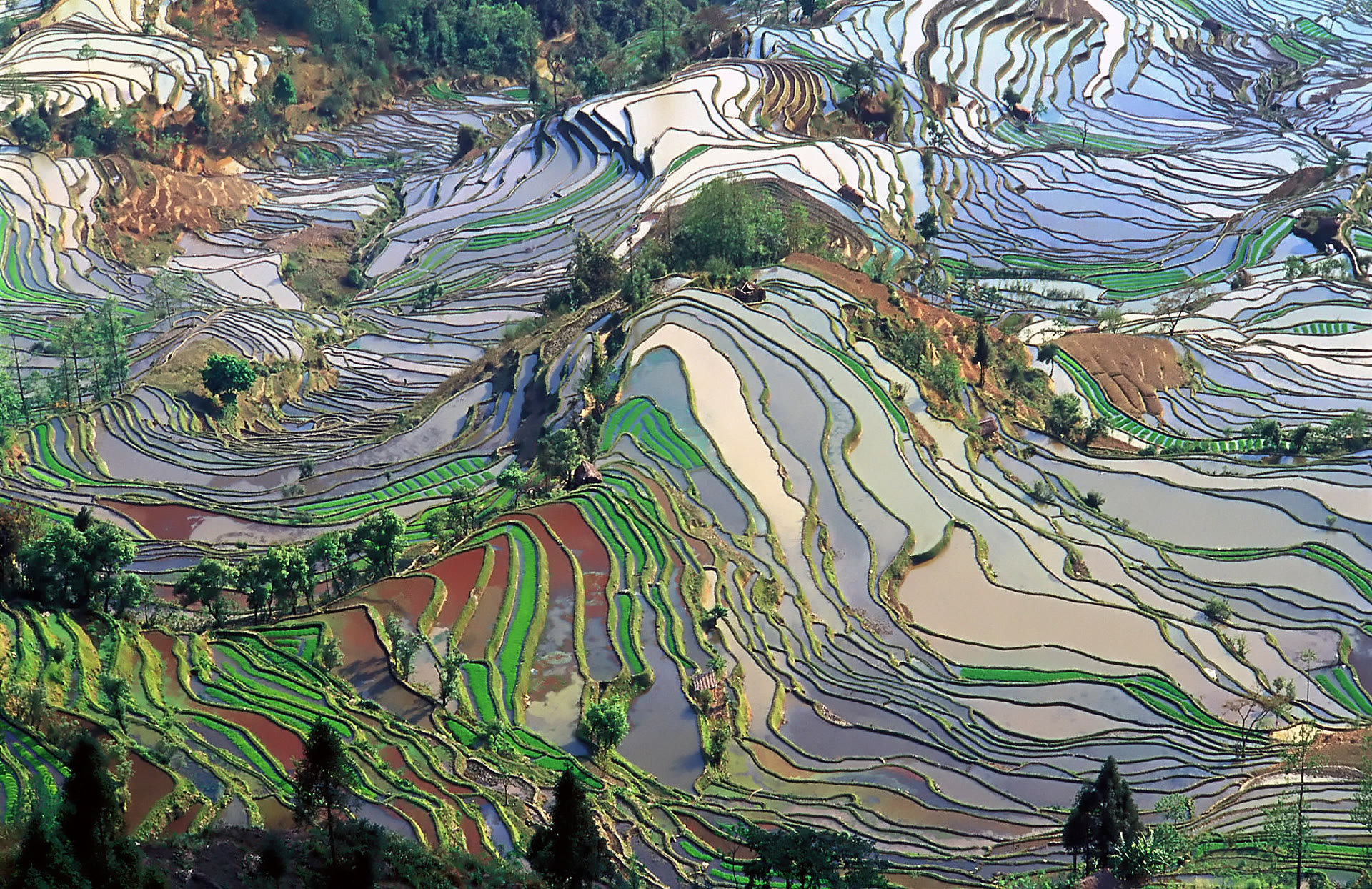
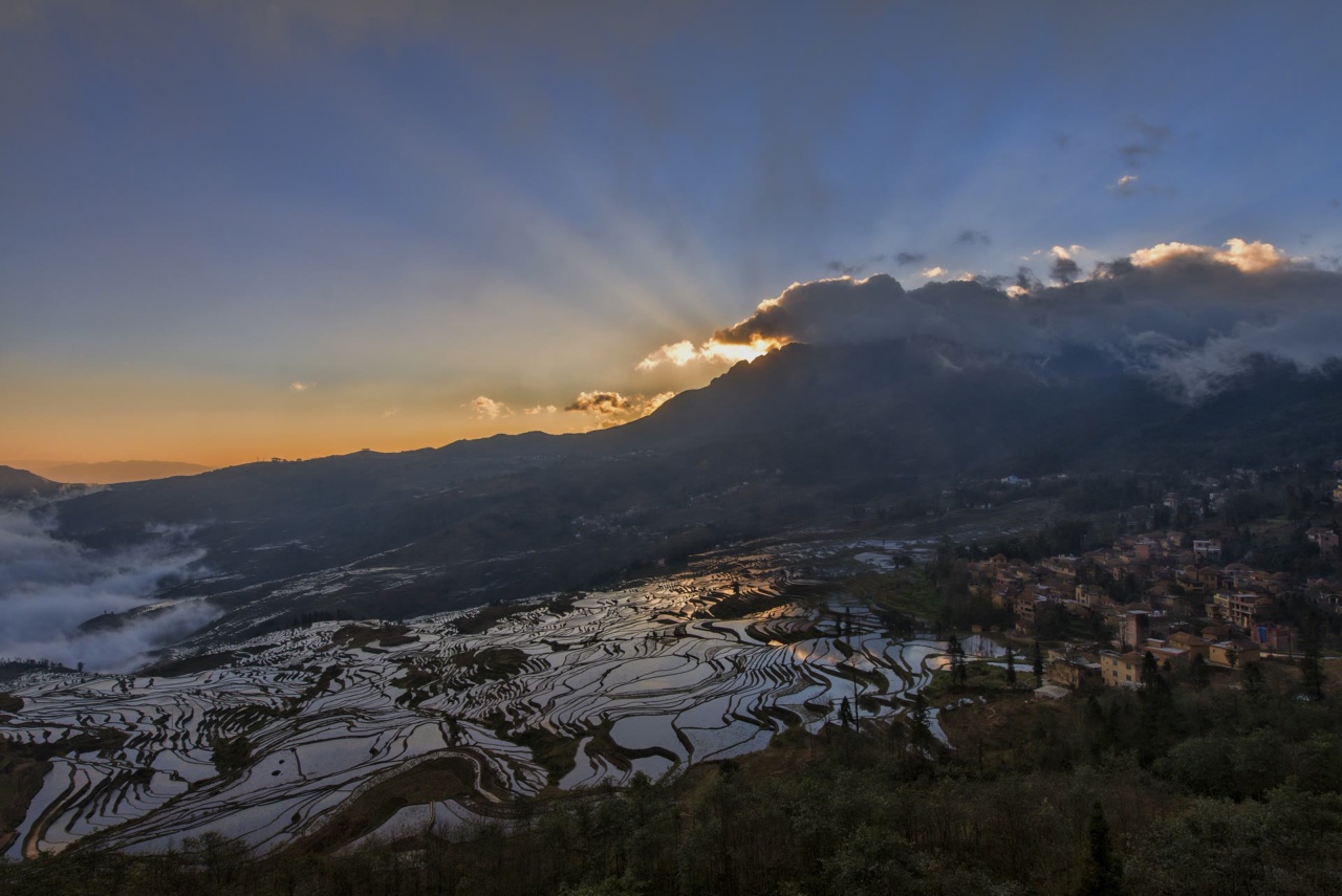
The Yuanyang Rice Terraces are part of the Honghe Hani Rice Terraces cultural landscape in southern Yunnan. UNESCO describes a 16,603-hectare property on the slopes of the Ailao Mountains, where Hani communities have built channels from forested heights to the terraces over roughly 1,300 years. This is a lived agricultural landscape, not a single viewpoint attraction.
Choose your first viewpoint
For sunrise, start by considering Duoyishu; for a separate sunset stop, consider Bada. Laohuzui offers another valley-facing terrace landscape. These choices follow a Honghe Prefecture government visitor guide published on 18 March 2019. Check which viewing areas are accessible for your travel date before arranging a driver or accommodation; the older guide is not a current operations notice.
Things to Do
Offers are only loaded from GetYourGuide after you click. GetYourGuide can then process your IP address and set cookies. Privacy Policy
GetYourGuide partner offers. GoAsia may earn a commission if you book through these offers. Check whether tickets or transfers are included, and follow the attraction's official booking and admission rules.
Choose a base and plan transfers
The guide distinguishes Yuanyang County town from the old town of Xinjie. Its published distances give a useful sense of the different bases, but are not distances between viewpoints or current driving times.
| Viewpoint | From Yuanyang County town | From Xinjie |
|---|---|---|
| Duoyishu | 53 km | 23 km |
| Bada | 44 km | 14 km |
| Laohuzui | 50.5 km | 20.5 km |
If dawn photography is your priority, a useful planning approach is to choose accommodation near your intended first viewpoint and agree the pickup and return arrangements in advance. If you want both sunrise and a separate sunset stop, leave a full day in the area rather than planning a quick stop between long transfers. These are editorial planning suggestions, not an official tour duration.
Before booking transport, ask for the exact accommodation and viewing locations, the planned route, estimated driving time, waiting time and return arrangement. Confirm whether a quoted price is per person or for the vehicle, and whether any admission or parking charges are separate. The cited guide does not establish current fares, public transport schedules, opening hours or ticket arrangements.
Plan for the landscape, not a guaranteed photograph
The forests, villages, water channels and fields form a connected farming system supporting red rice. A description of that system is not a promise of flooded mirror terraces on a particular date. Ask locally about field conditions before choosing a photography morning, and leave room in your plan for weather to change.
Respect a working cultural landscape
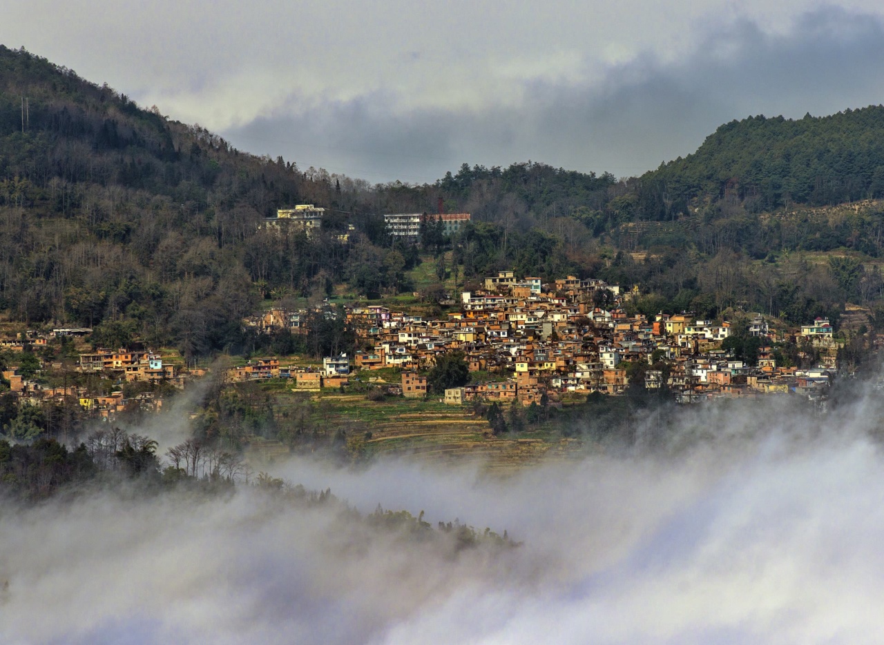
UNESCO describes 82 villages between the mountain forests and the terraces, including traditional thatched houses. Treat village lanes and paddies as lived and worked spaces: ask before close-up portraits, keep to paths, and do not walk across planted fields for a photograph.
Sources and background
These sources support the topics listed below, not every statement or current price in this article.
- [1] UNESCO World Heritage Centre: Cultural Landscape of Honghe Hani Rice Terraces. Retrieved October 6, 2026. History, Culture, Nature
- [2] Honghe Hani and Yi Autonomous Prefecture People’s Government, page content by Honghe Prefecture Culture and Tourism Bureau: Honghe Hani Rice Terraces Scenic Area. Retrieved October 6, 2026. Access, Nature, Culture
Frequently Asked Questions
UNESCO describes a 16,603-hectare cultural landscape on the Ailao Mountains in southern Yunnan. Its forests, water channels, villages and rice fields form a connected Hani agricultural system. Yuanyang County is one part of the wider Honghe region.
A Honghe Prefecture government visitor page names Duoyishu, Bada and Laohuzui. It describes Duoyishu as a sunrise viewpoint, Bada as a sunset viewpoint, and Laohuzui as a valley-facing terrace area. Confirm local access before you travel.
The Honghe government guide published in 2019 lists Duoyishu 53 kilometres from Yuanyang County town and 23 kilometres from Xinjie; Bada 44 and 14 kilometres respectively; and Laohuzui 50.5 and 20.5 kilometres. These are distances from those two bases, not distances between viewpoints or current driving times.
No. UNESCO describes the agricultural water system, but the sources here do not establish a current seasonal calendar or guarantee water levels. Ask locally about field conditions for your dates, and keep your plan flexible.
Agree the exact stops, pickup, waiting time and return arrangement with your accommodation or driver. Check whether the price is per person or for the vehicle and whether admission or parking charges are separate. The official Honghe guide does not confirm current buses, schedules, charges or road access.
As a planning suggestion, leave at least one full day in the area if you want both sunrise and a separate sunset viewpoint. This is editorial advice, not an official tour duration. Add travel time to and from your arrival point.